The territory in the floodplain of the Lielupe coast was transformed in 1964, with the construction of the Lielupe treatment plant. Today, after the end of their operation, it has both scenically and spatially fabulous potential, both functionally on a local and regional scale. The symbiosis between the natural landscape and the architectural, functionally designed human space is a vital necessity in this context. Therefore, the roles in this cooperation are very clearly defined – man and his handiwork, including architecture, upon entering the floodplain, accept its rules and are subordinated to it, borrowing only as much as is necessary.
Method
Public understanding of architecture and spatial environment formations mostly happens through stories, because the viability of architecture depends primarily on whether the public accepts and understands the specific object or a series of them. The range of stories creates a set of images, or social imagination, which is a link between people, place, time (past and present), creating visions of the future in people’s minds. The social imagination creates a community’s collective memory and sense of community, which in turn creates a sense of belonging to a particular place. These stories should be as important as the objects themselves, their architectural-spatial quality, aesthetics and functionality. On the contrary, when spatial historical evidence is destroyed, part of the social imagination and collective memory is also destroyed, the identity of the place is destroyed.
The basis for the thesis proposal is the method based on the idea that partial incompleteness is very important in the creation of spatial structures, meaning the level of spatial order. In spatial structures, it is essential to leave room for the interpretation of their users, without creating a feeling of completeness, which is often oppressive. This same attitude can be used in the relationship between natural and artificial, man-made space. Seeing architecture as a spatial level of order opens up a wider range of possibilities for its users, which is the most important task of architecture.
The problem
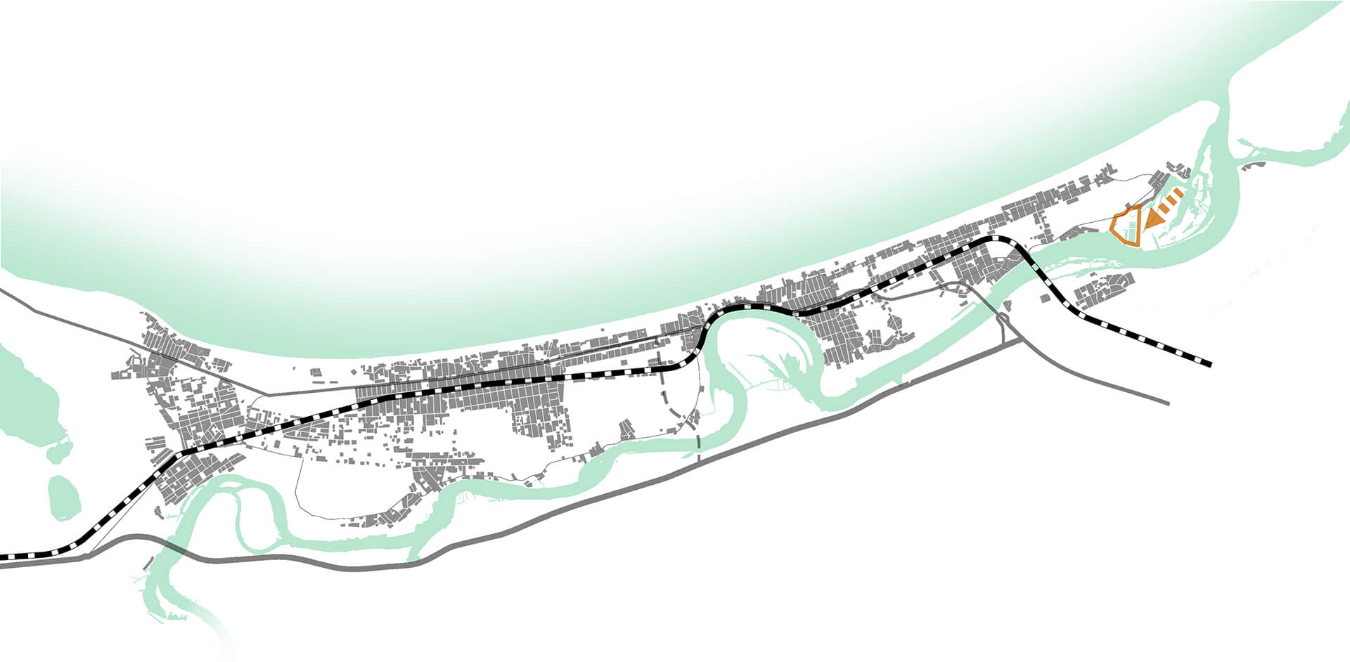
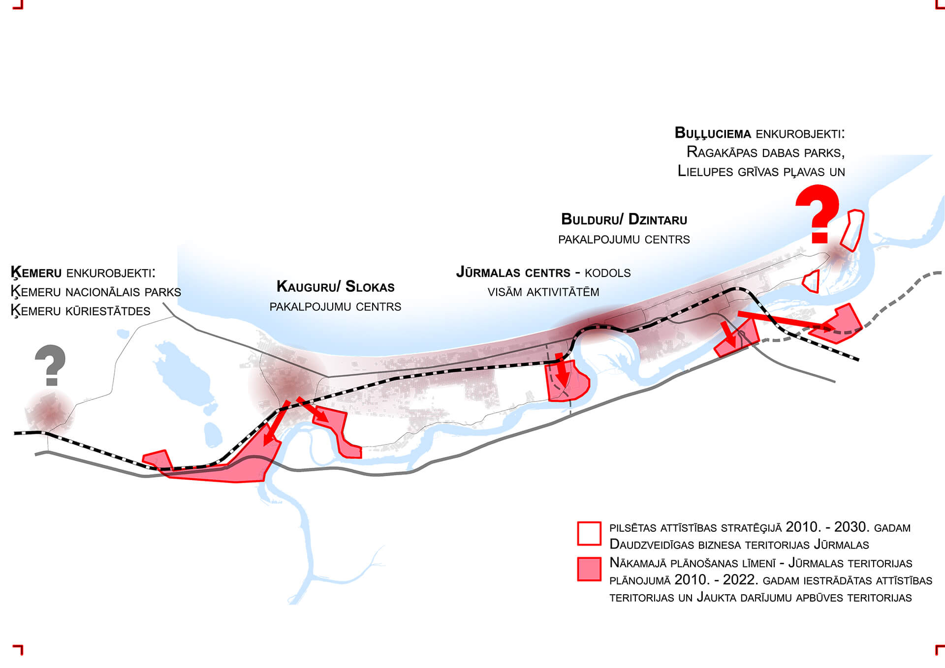
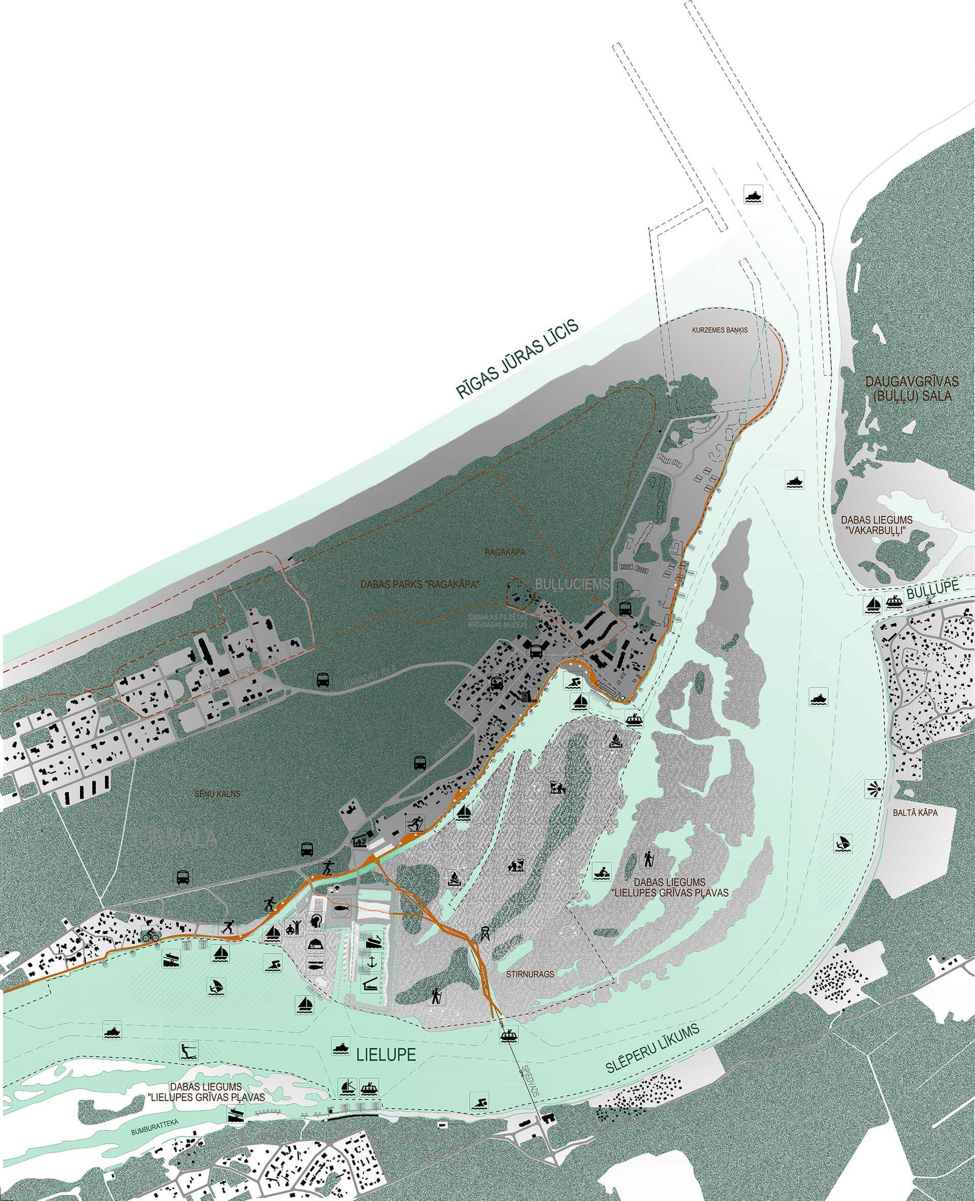
Today, the main flow of people in the city from Riga enters Bulduri and reaches the center of the city along the waterway. Starting from Bulduri up to Dubulti, we can talk about the part of Jūrmala that is “on the path” for every interested person, where all the functions of the city are located. Accordingly, the western and eastern ends of the city remain “behind the frame”, which historically has not been the case for various reasons. As a result, these further parts of the city – Sloka, Kauguri in the west and Lielupe, Stirnurags, Buļļuciems in the east – have become a place for living only, or so called habitats. The situation in the eastern part is still significantly affected by the railway crossing, which “cuts off” the neighborhood from the rest of the city, making it difficult to get there and to engage in any social activities.
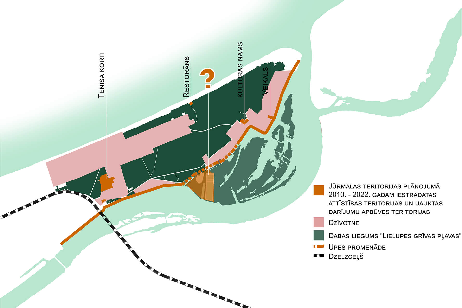
Efforts to achieve a balance of development, which were noticeable in the development strategy of Jūrmala for 2010 – 2030 in several positions, have not survived until the recently approved Territorial Planning of the city of Jūrmala. Such a fate has also befallen the territory of the former unwinding facilities on the Lielupe coast, limiting its development from a development area and diverse business environment to the territory of the marina. Such A turn of events threatens and limits the harmonious development of the entire Buļļuciems, Stirnurags and Lielupe neighborhoods and, to a certain extent, development in general.
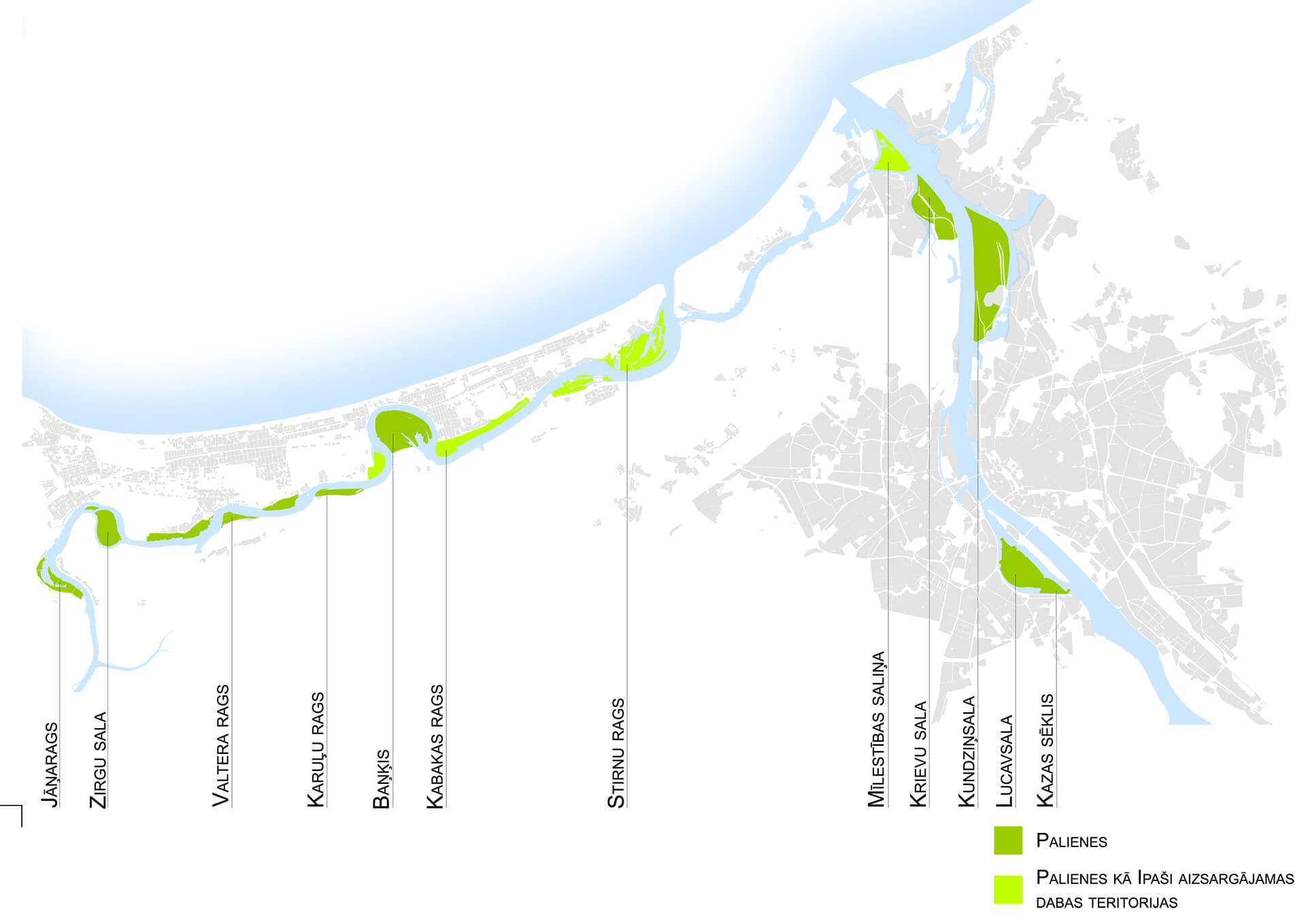
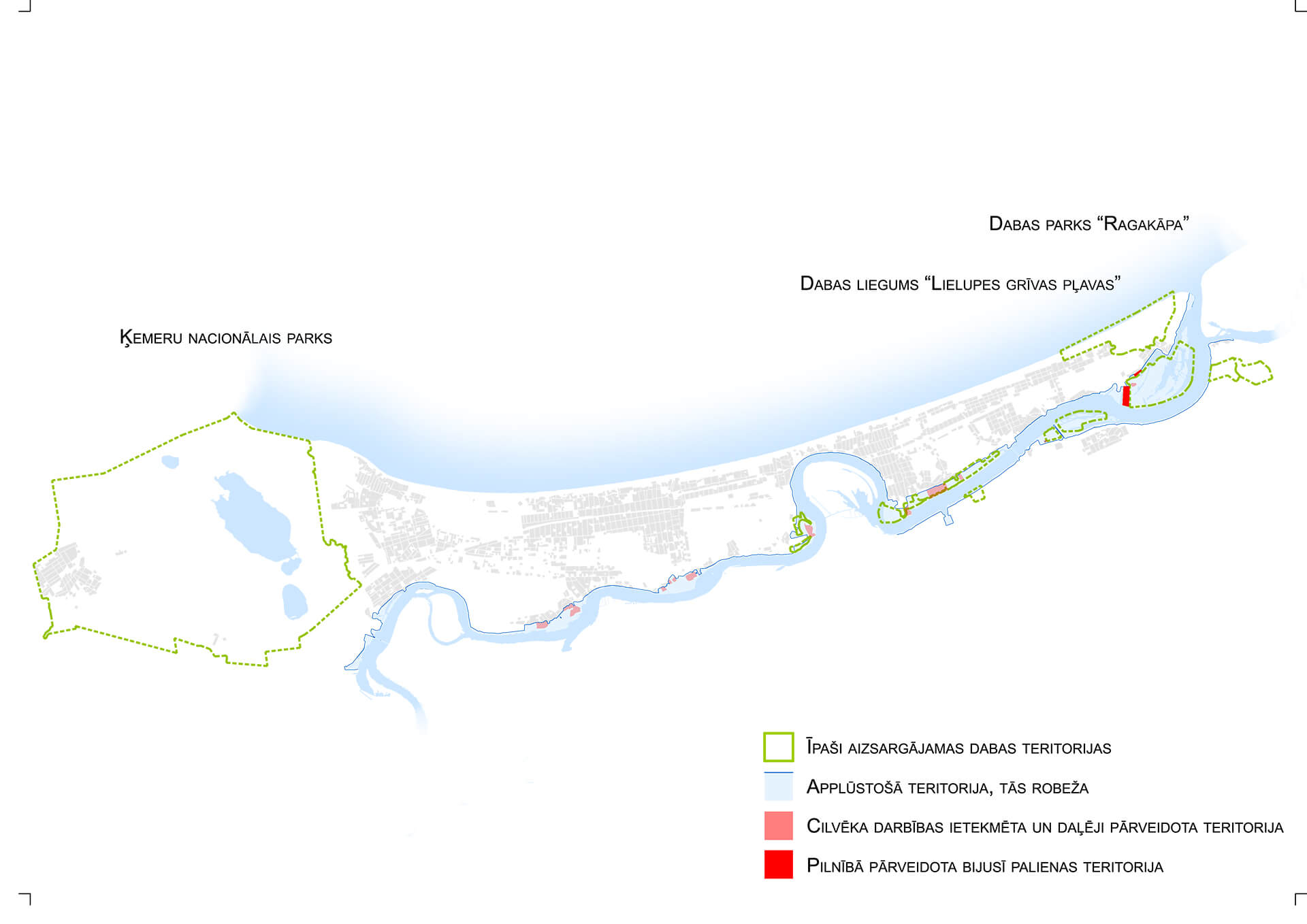
In the context of the possible development of the Lielupe area, when studying the flooded areas, the territory of the former treatment facilities in the mouth of Lielupe stands out. It is the only area in the entire city that is a former floodplain completely transformed by human activity. Such a degraded and unused environment with huge site and landscape potential is a unique opportunity to bring people and the river together again, allowing for the creation of a high-quality and vitally needed public space by the water.
A significant problem, both for the neighborhood and the whole city, has arisen with the port of Lielupe. Historically, it was formed on the territory of the former fishermen’s collective farm “Uzvara” (later A/S “Jūras līcis”) in Buļļuciems. For the moment, the port of Lielupe has been declared closed due to sand drift at the mouth of the river. According to the current detailed plan, the historical territory is intended for another use that is not related to the function of the port and the interests of the municipality. The development of the port of Lielupe is associated with international yacht tourism, but in order to achieve this, the construction of a jetty at the mouth of Lielupe itself, which would stretch a kilometer into the bay and protect the mouth of the river from clogging, is necessary. In the Lielupe utilization plan, which was adopted in the summer of this year, the jetty is planned together with a constructed niche or pocket, which in such a solution would be a kind of compromise to the problem that there are no land areas at the mouth of the river in the management of the port. However, the solution would have a unequivocally negative and degrading effect on the untouched and unique space and landscape of the river.
The river promenade
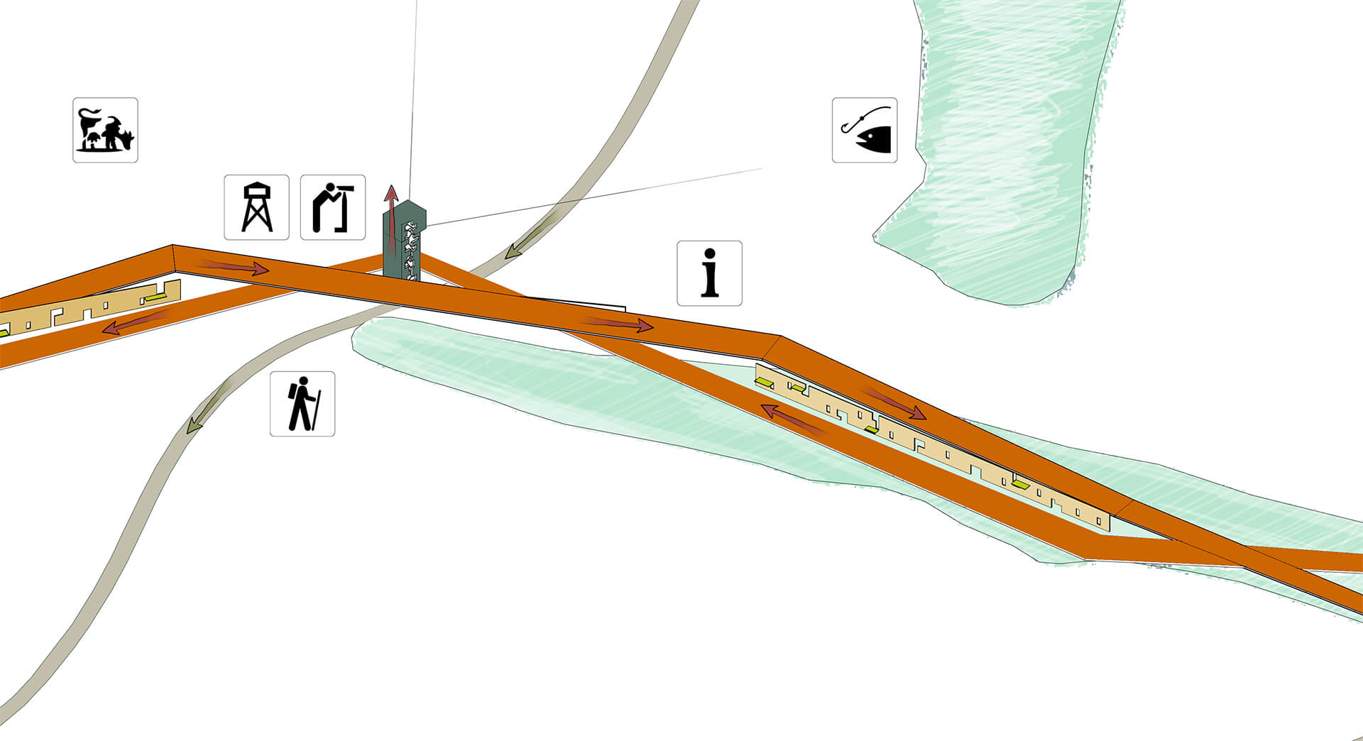
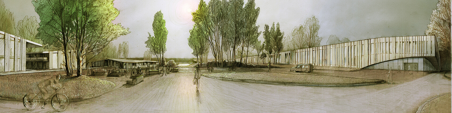
On an urban planning scale, the diploma project deals with the proposal for the creation of a promenade along the left bank of Lielupe. It is an idea that appeared in the first edition of the Territorial Planning of Jurmala for the next 12 years, but it did not make it to the final edition. At the specific stage, the promenade would allow spatially and functionally convenient connection of Buļļuciems with Stirnurags and the rest of the city. The promenade is designed as a functional axis including rest areas and various stopping points, such as ice cream, coffee or other product kiosks, as well as various recreational and sports equipment rental points.
Floodplain stage
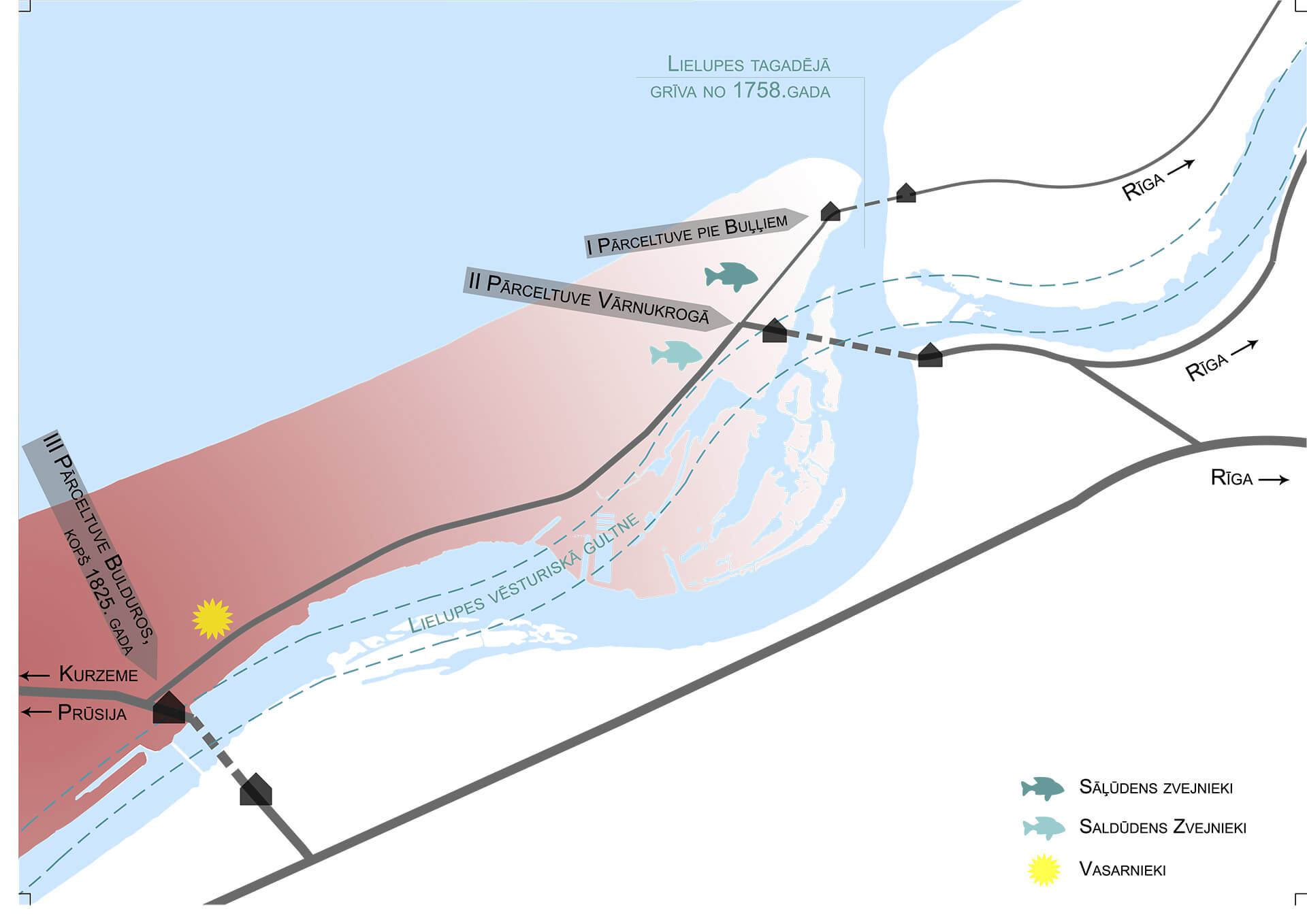
The Daugava river in the territory of Riga has been changed and modified over time and its owners have changed, and its banks have been strengthened and filled up without measure, until finally, in Riga, pali as a phenomenon has been completely eradicated, with the construction of hydroelectric power plants. In Lielupe, pali is still the most important spring event for most seasiders. Pali is a beautiful and significant moment in the cycle of seasons, when nature’s desire and vigor to wake up from winter sleep are clearly marked. This moment is worth celebrating!
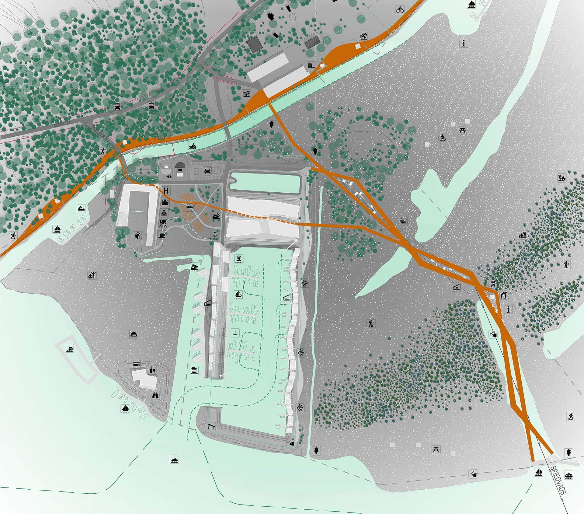
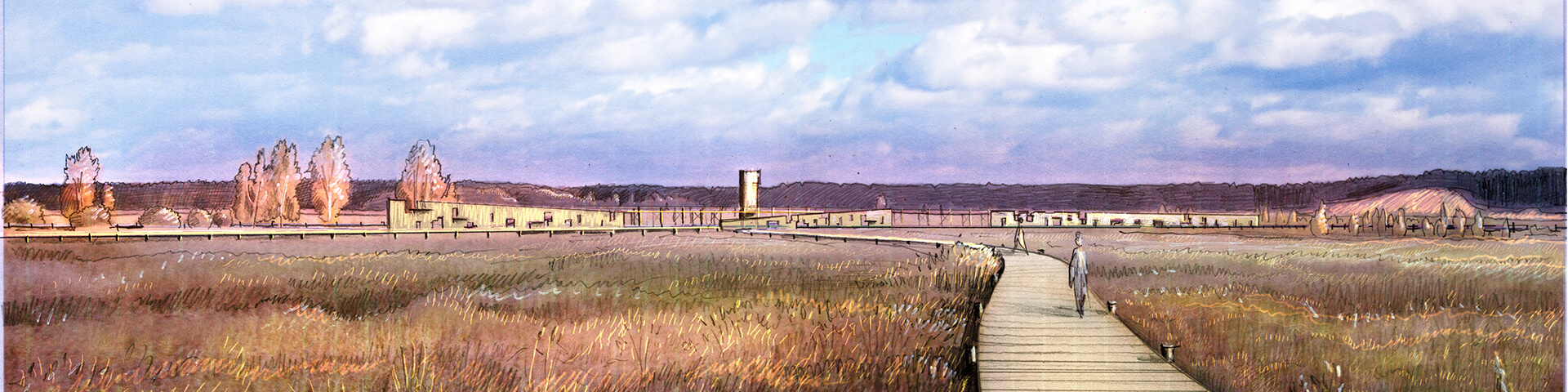
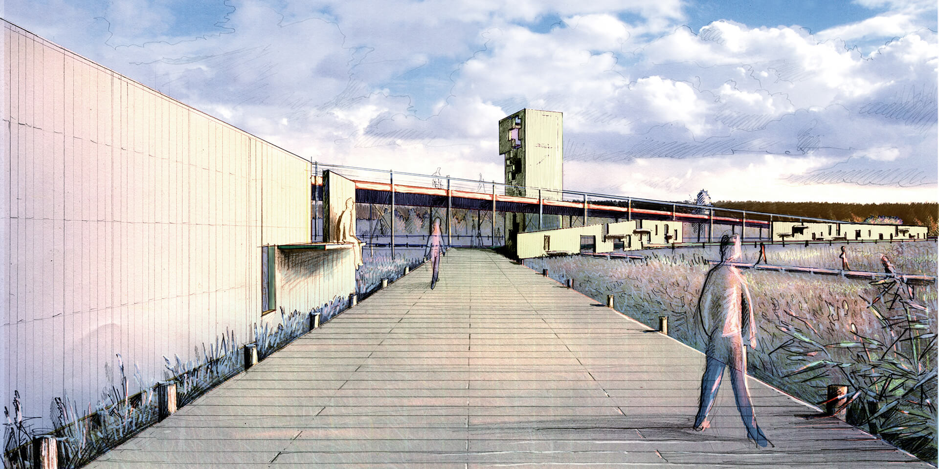
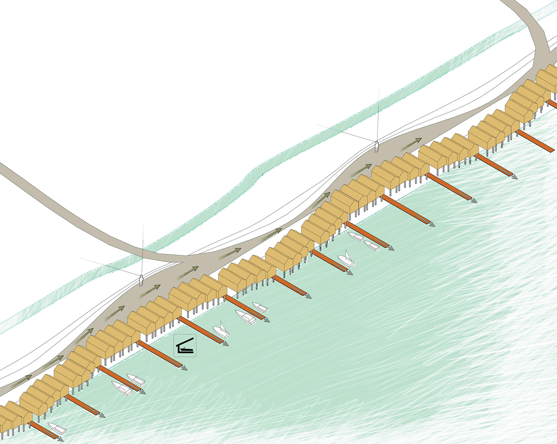
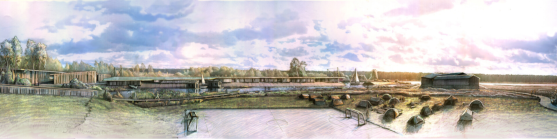
During the Tsar’s time in the 19th century in the middle of the year, a “river wedding” was celebrated, when after Miķeļi equinox the fish saving time ended. Why not celebrate the banks to bring life back to the shores of Lielupe. As part of the diploma project, a plan has been developed for the stage of the Lielupe floodplain, which is a system of footbridges and vertical resting “shelves”. The culmination of the stage is during the floods, when the footbridges on several levels are filled with people watching the ice walk in Lielupe. The stage of the floodplain is formed from the northeastern end of the territory of the former treatment facilities, from the place where the built sewage pressure pipe begins, which crosses the floodplain and continues under Lielupe to the Daugavgrīva treatment facilities. On the other hand, the flood stage functionally and spatially ends on the left bank of the Lielupe River with the public water transport boat stop.
The scene of the floodplain seen from the water, starting with the boat dock in Slēperi bend, at the mouth of Lielupe itself in the bay, forms a unique “gate” of Jūrmala, which marks Jūrmala’s landscape both spatially and plot-wise. A system of footbridges leads visitors from the banks of Lielupe itself, introducing them to the natural values of the floodplain.
Yacht harbor and boat docks
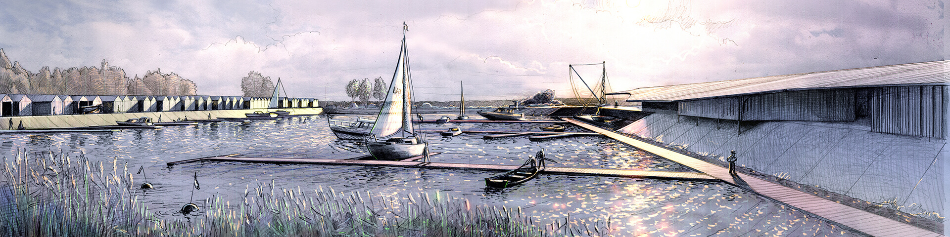
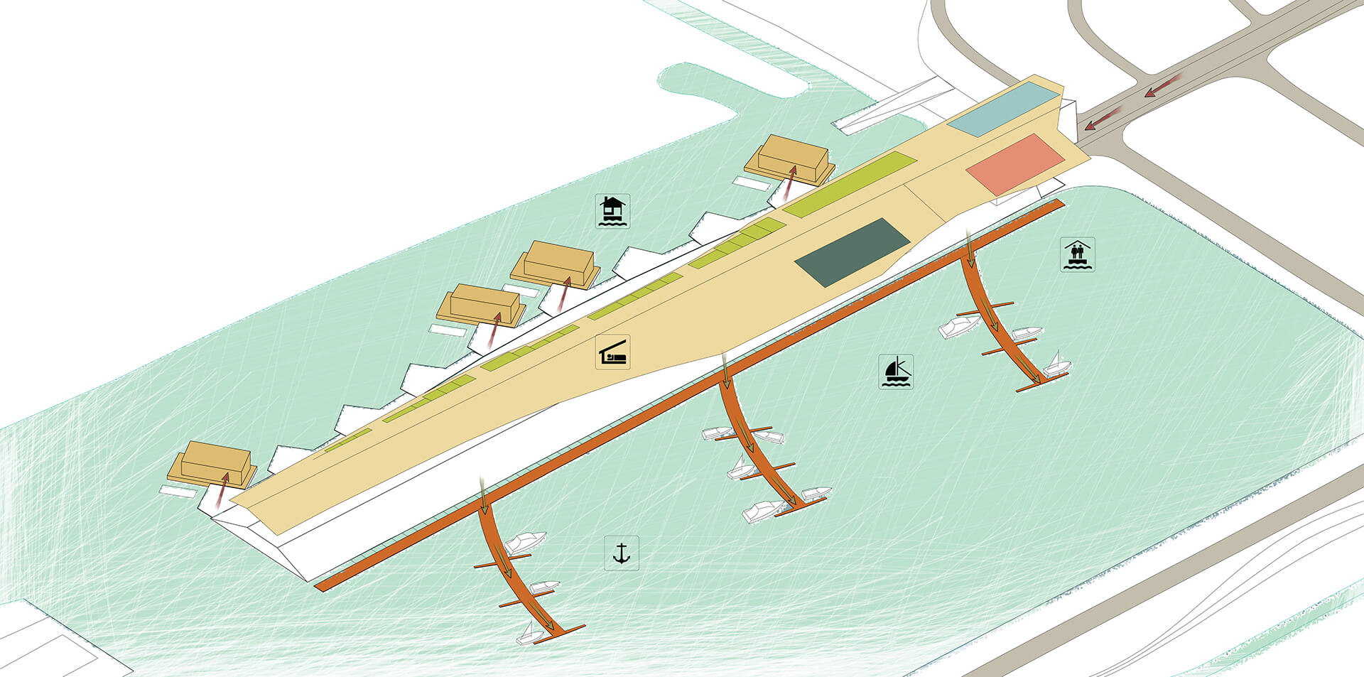
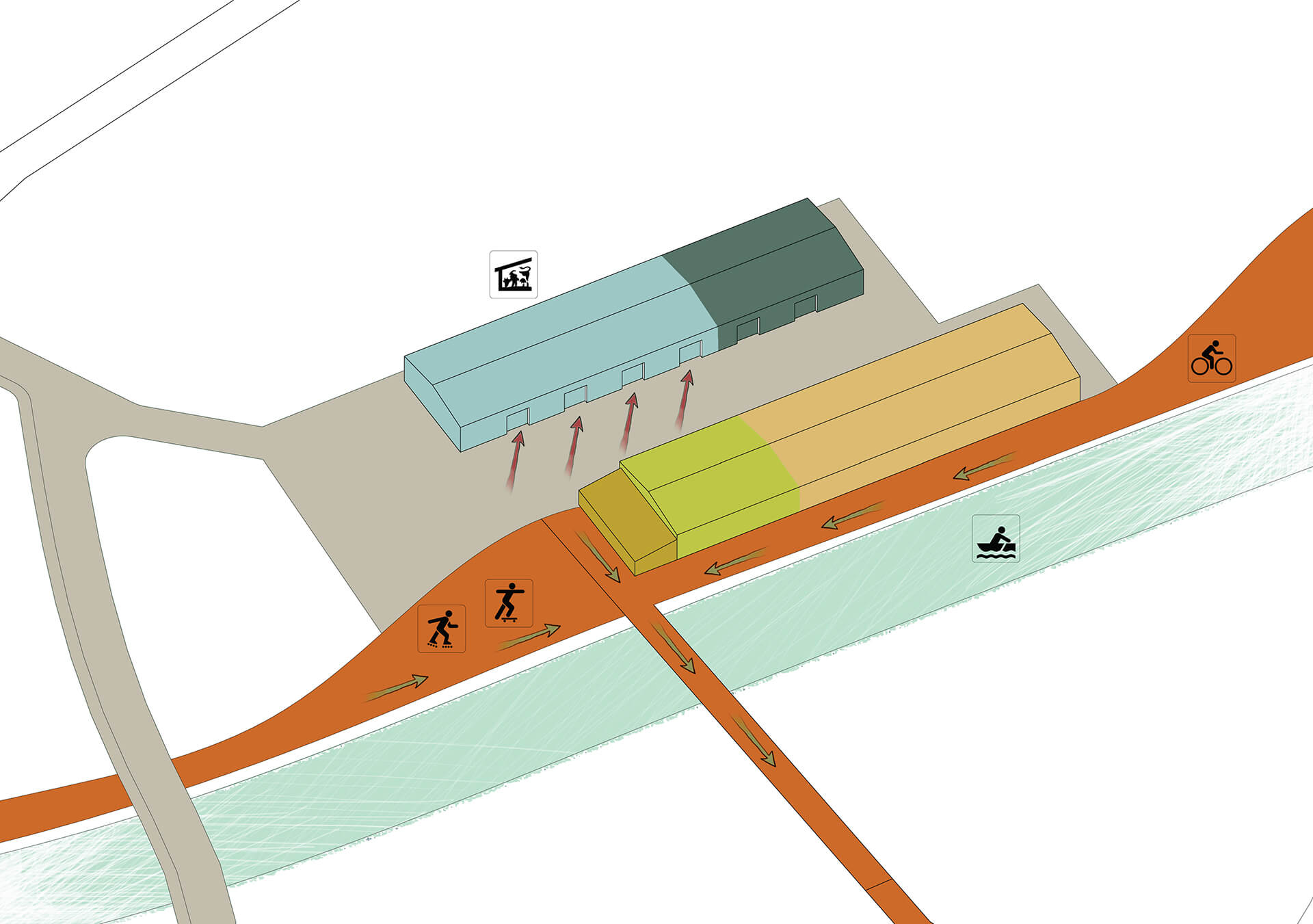
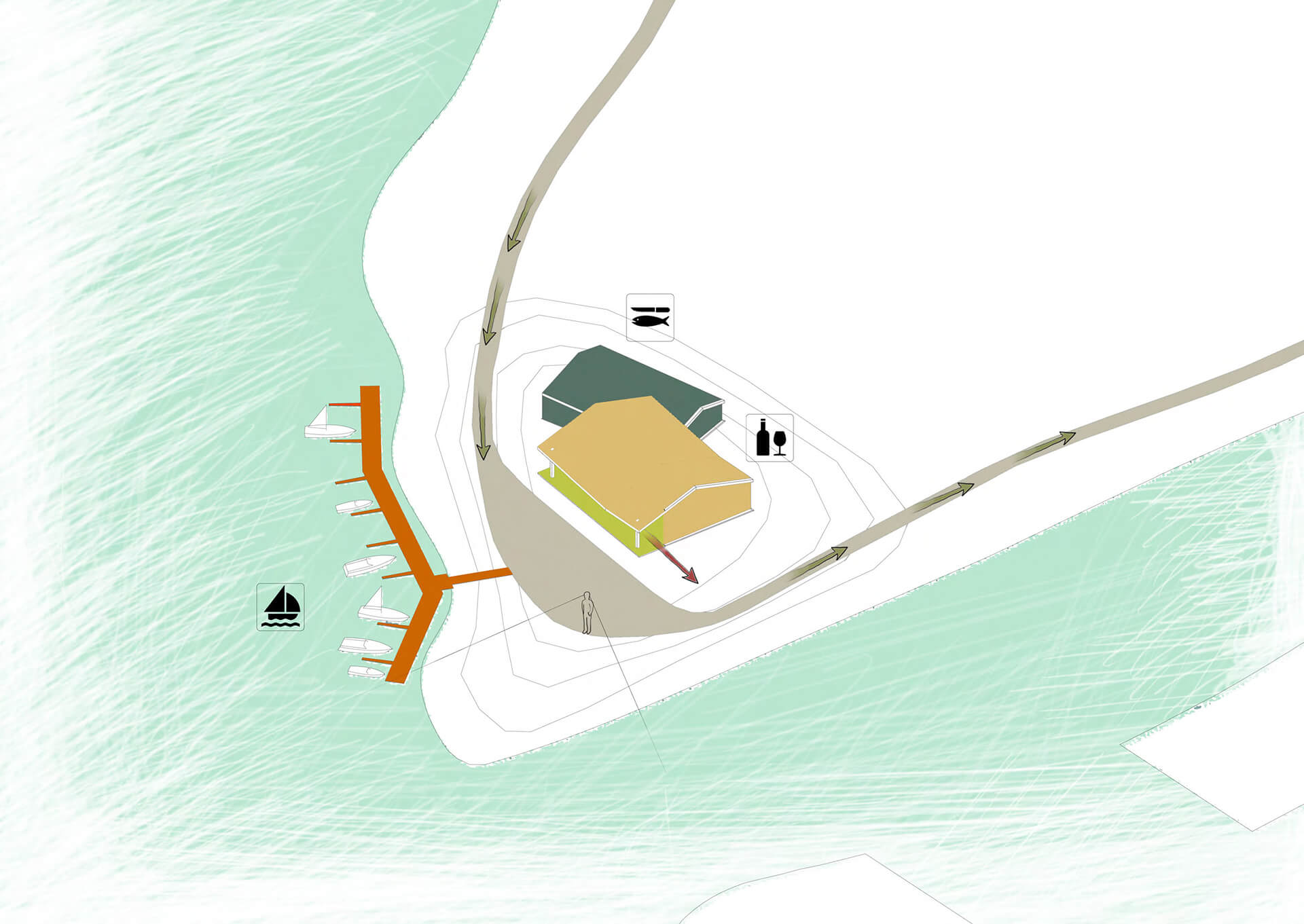
Across the floodplain, approaching the territory of the former treatment facilities, the harbor basin opens into view. The skill and practice of “embedding” in water can already be observed in many places in the world and also in Latvia, but finding the opportunity to invite water inland is less common. In the specific case, in 1964, the territory of the Lielupe floodplain was taken away by the construction of concrete sedimentation basins, a tolerant action would be to return at least part of it to the river. In order to use the existing sedimentation basin for shipping and port purposes, it must be deepened and a break created in the concrete banks of the basin. On the right bank of the pool, boat ramps are organized, which in the proposal of the diploma project are moved from the beach adjacent to Buļļuciems, as a result of which it would be possible to turn it into a recreation area in the immediate vicinity of residential buildings. The western shore of the port basin is designed as a spatially unified object, combining “under one roof” all the functions necessary for an international marina. Functionally, it is divided into independent volumes connected by a covered outdoor space.
Boat construction
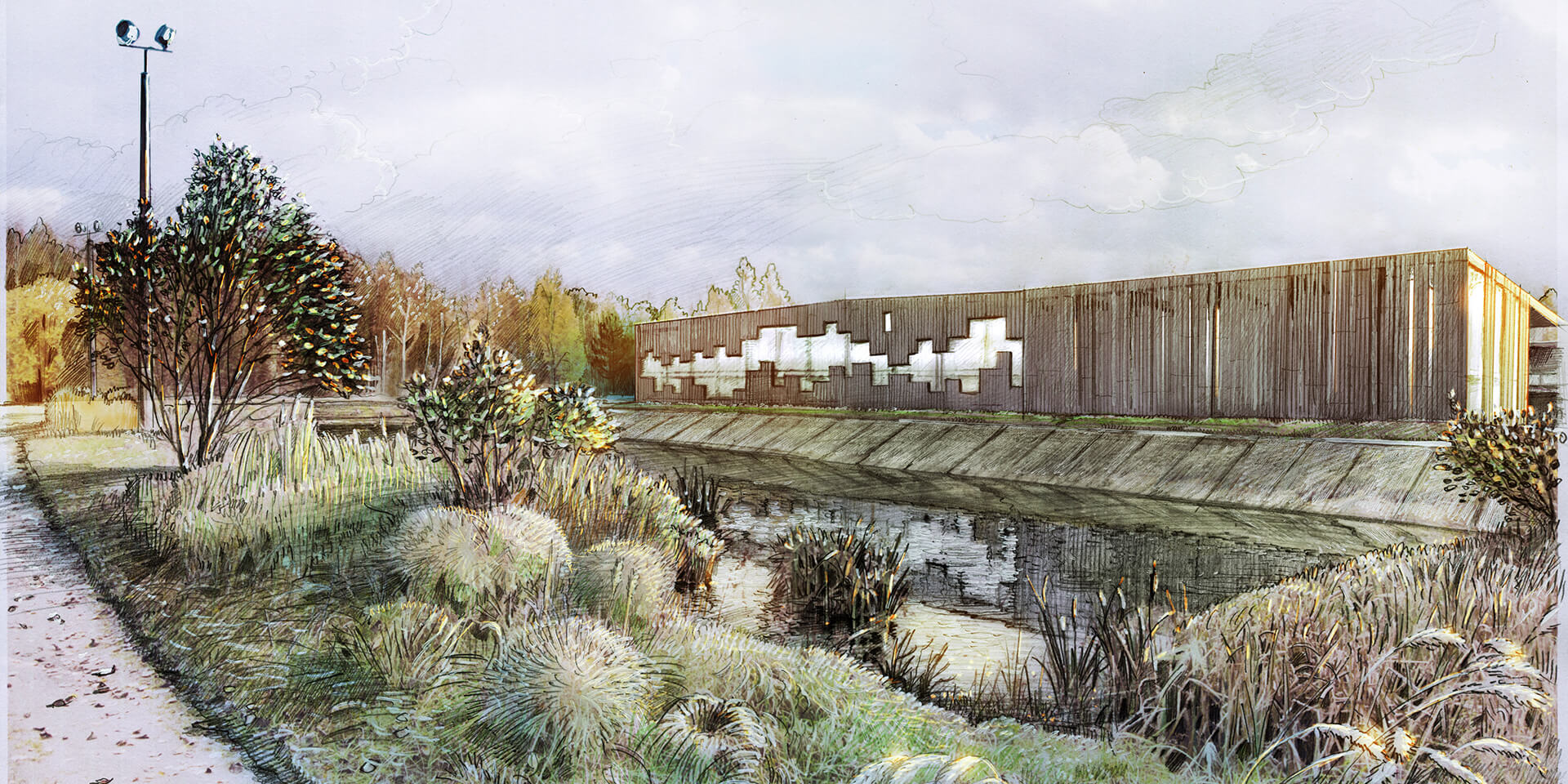
When reaching the territory of the former treatment facilities, the footbridge system continues through a pair of boat building volumes, telling the next stage of Jūrmala’s history, present and future. The function is rooted in the historical development of Jūrmala as a series of fishing villages and especially highlighting the experimental boat factory “Dzintars” experienced in the not so distant past. In Jūrmala, there is a vital need to develop innovative production that would be able to compete in a wide market. In a place as rich in water as Jūrmala, it should be possible to order and buy such a product as a wooden boat, it should be part of the city’s “business card”. Accordingly, making the road section through the boat building, the traveler arrives at the central square of the territory – the fish market, where he is definitely destined to taste some smoked meat.
Barn and pasture
An important stopping point along the riverside promenade to the north of the market square is the former military garage, which, as part of the diploma project, is proposed to be reused as stables for cows and horses that graze in the floodplain meadows. The main problem of the meadows is their overgrowth and its most effective solution – grazing, which was historically rooted and has already proven itself, today it could be supplemented with a small dairy production plant and a kiosk in the premises of the former military garages, which opened onto the axis of the promenade.
Pub and camping
Due to the repeated changes of the Lielupe bed, Stirnurags “shelter” (between the administrative name of the part of the city and the geographical name of the cape) has become unclear. This fact, as well as the story of the raft pub and its many relocations, until it finally remained near the territory of the former treatment plant, complements the purely functional need for a simple dining and resting place on the banks of Lielupe. Such a public function on the river bank should be like a road goal worth measuring. As a result, by creating a hill south of the market square on the southeast side of the floodplain meadow, using the soil created by the dredging of the harbor basin and drain, a restaurant / pub will be placed on it. In this way, the “sloped” position of the Stirnurags is emphasized and made clearer for perception.
The largest part of the floodplain to the west of the area of the former treatment plant and Stirnurags pub is occupied by an active recreation area and a camping site. All functions intended for the flooded area are not significantly affected by water fluctuations. If the water level in Lielupe is too high, you may not be able to play volleyball.
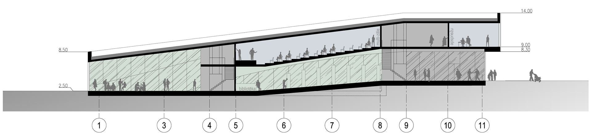
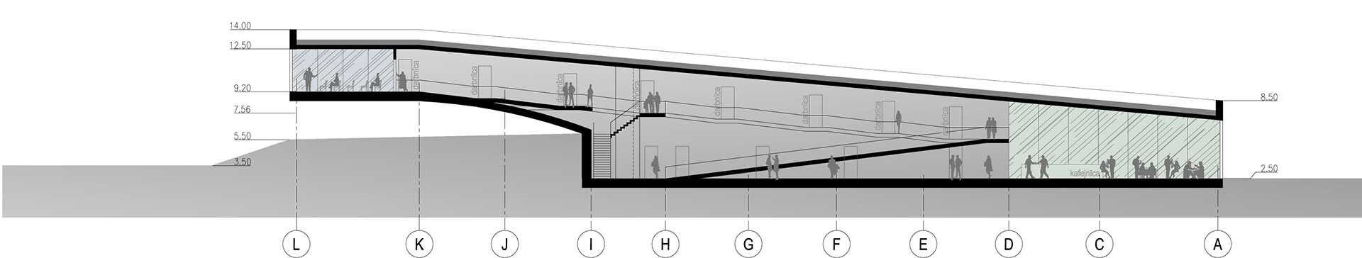
Incubator of ideas
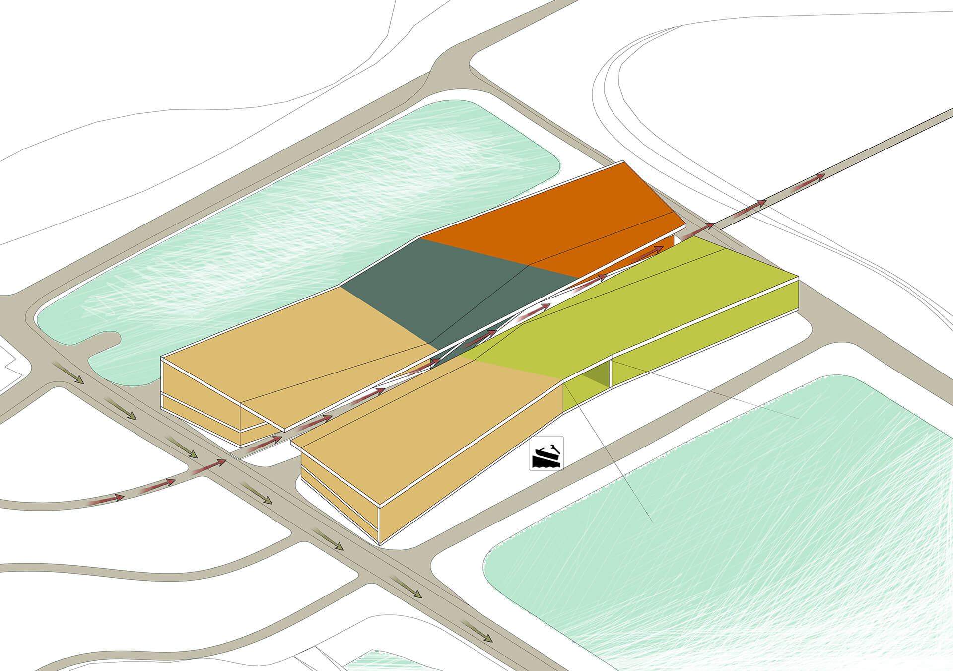
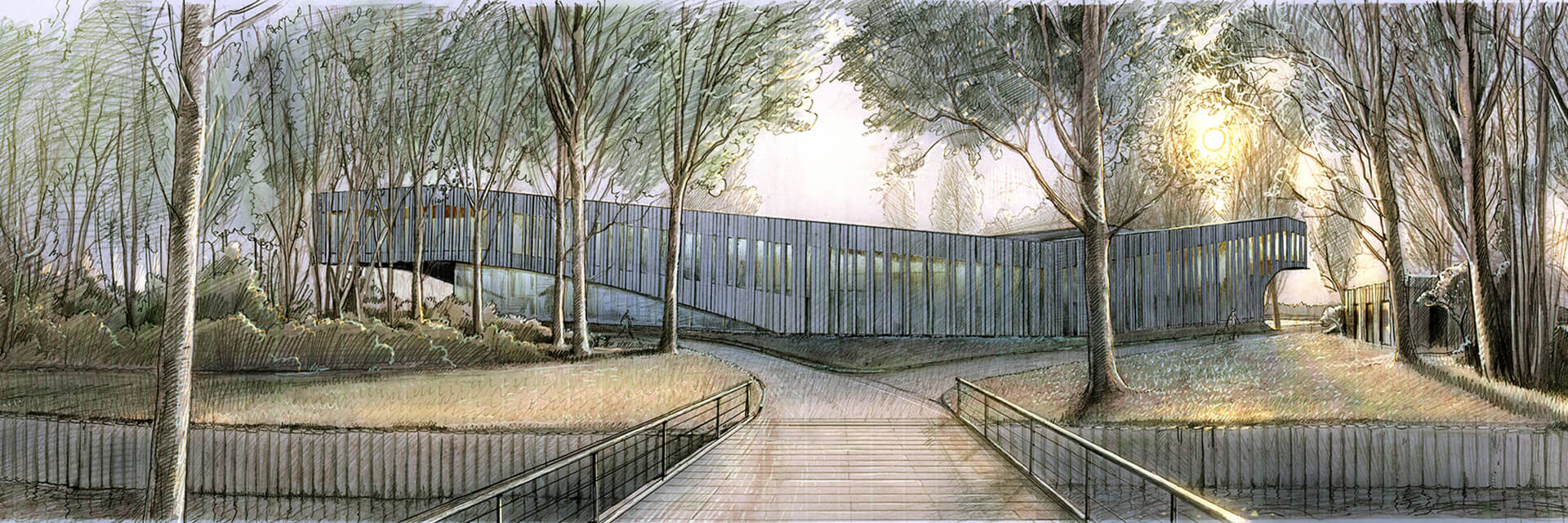
Finally, the western part of the market square is marked by the scope of the idea incubator. The functional basis of the building is based on the Jūrmala development priority determined by the Jūrmala City Development Strategy 2010-2030: Diversified entrepreneurship. Creative and innovative contribution is vital to achieving the priority. This set of events needs a “home” that can charge, motivate and inspire people for new ideas. The scope of the idea incubator in the territory of the former treatment plant is designed as a motif of the “gate” of the territory when approaching it from the land, at the same time not forgetting the backbone of the whole city – Lielupe.
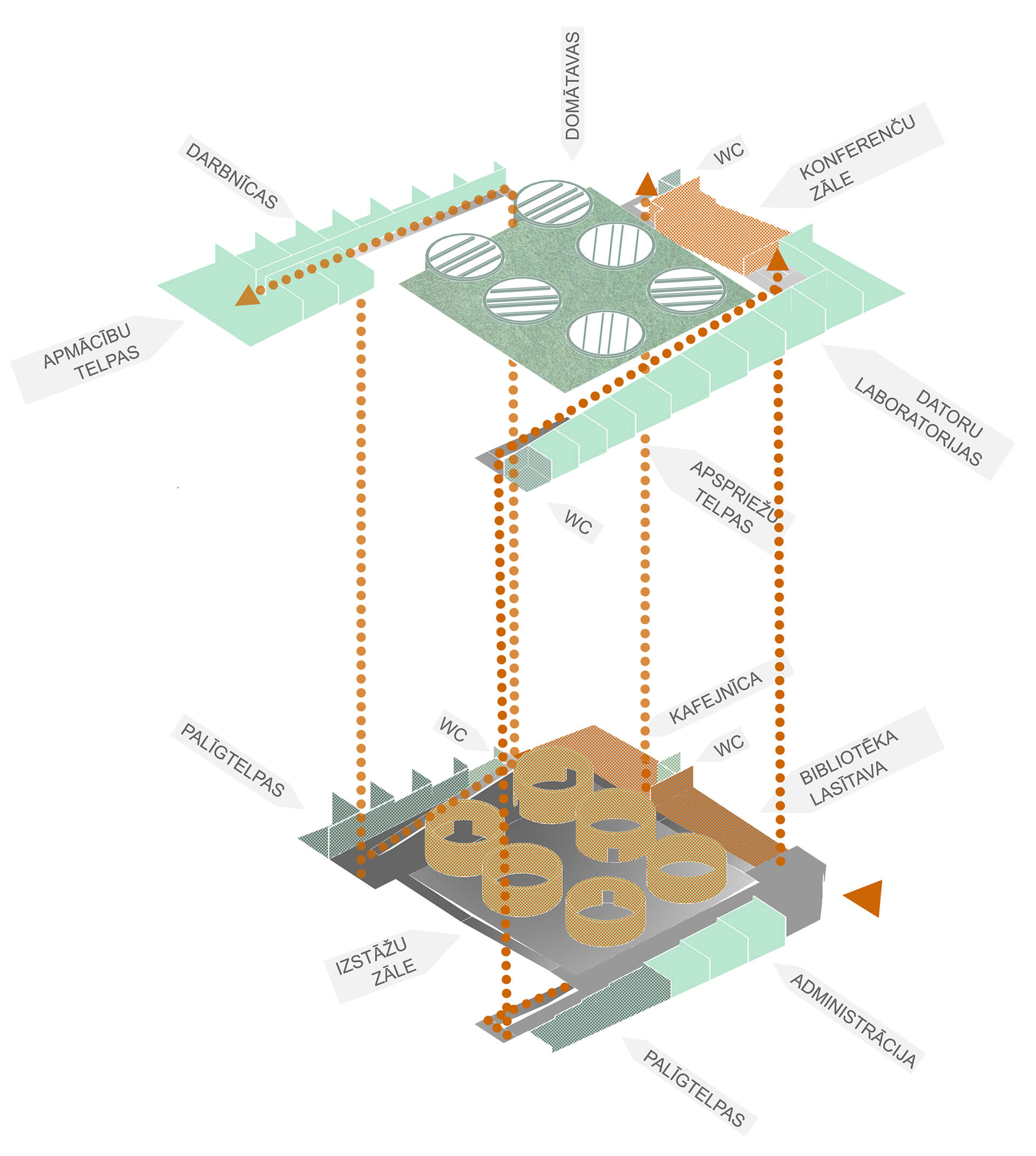
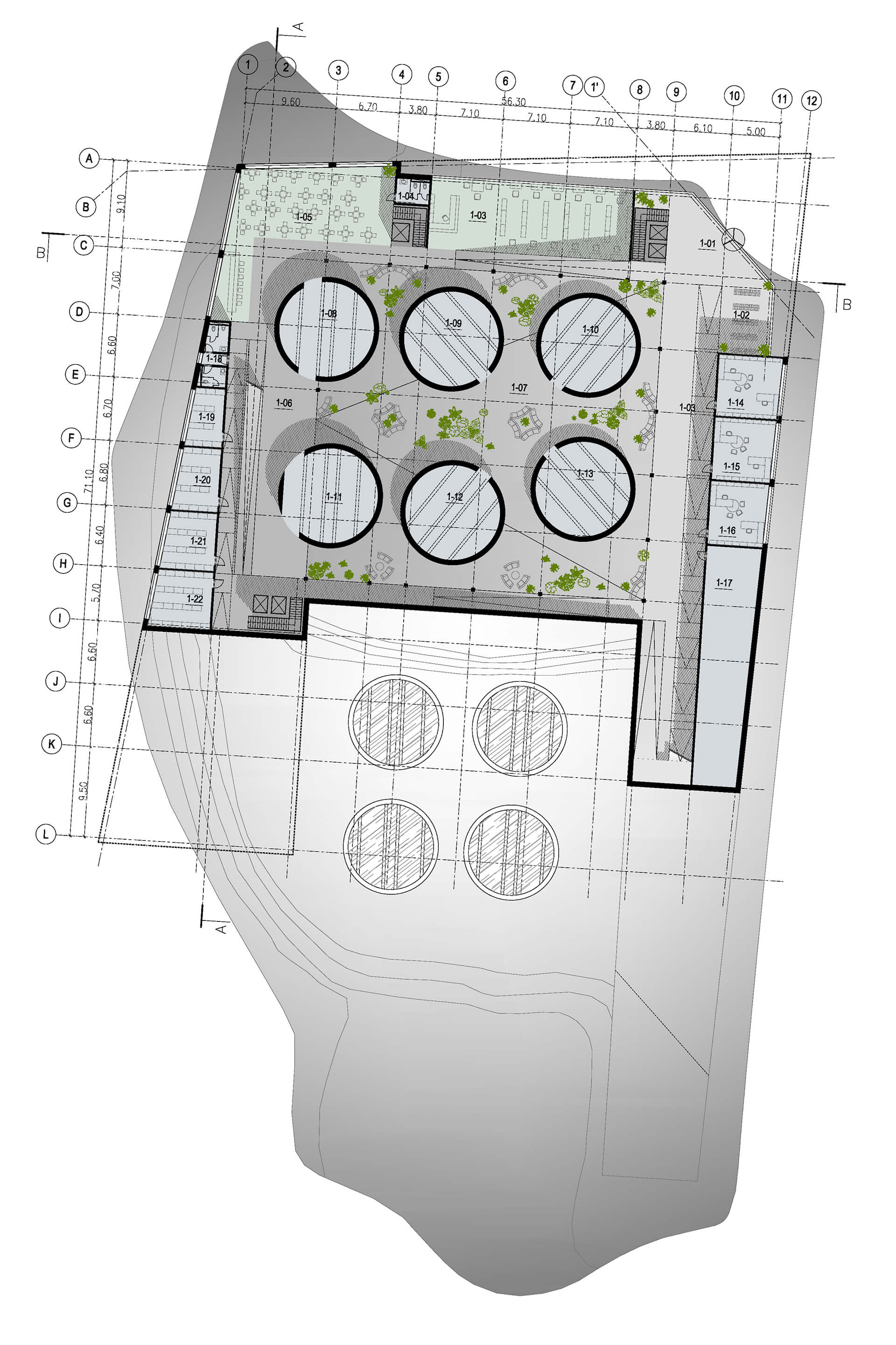
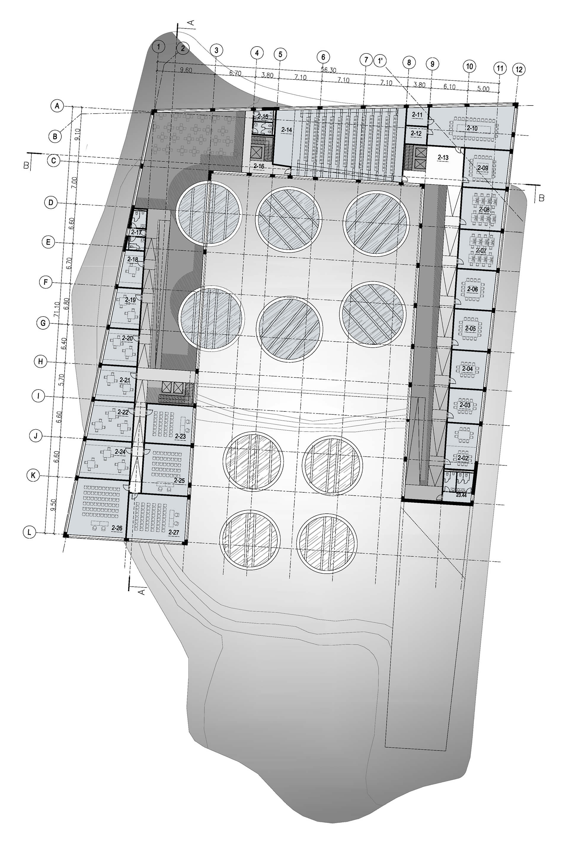
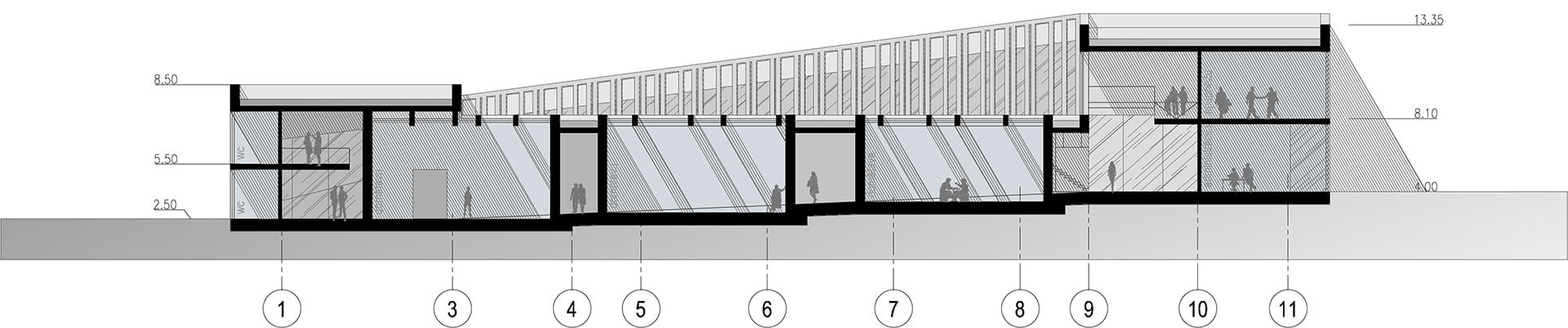
In the diploma project, within the boundaries of the considered territory, the hill that was once filled up stands out vividly, which reaches a height of 8 m, is hiding within itself six treatment facilities (concrete pits) buried in a diameter of 10 m. This is where sewage treatment started when the devices were still working, just like any business or activity in general starts with an idea. The volume of the idea incubator spatially wraps around the existing mountain of treatment plants, emphasizing its existence and changing its polarity to the opposite – the mountain becomes space (mass and void). In the next step, the volume responds to the surrounding context, rising above a natural and designed road that forms a loop connecting the area with the rest of the city. Also, this elevation towards the central place of the territory – the market square forms the main motif of the entrance. The exhibition hall located on the 1st floor of the building is built around six concrete rings, which serve both as light shafts in the interior of the room and as a “cabinet” of thoughts. In addition to the exhibition hall, the building’s conditionally open functions – library and cafe – are also located on the 1st floor level. Further, the next level of the building begins gradually climbing higher and higher along the ramps, organizing rooms along their entire length – workshops, meeting and discussion rooms, as well as a conference hall.